Abstract :
[fr] Carte topographique historique du début du 19e siècle, la Carte de Tranchot et v. Müffling couvre la plupart de la partie allemande de la Grande Région SaarLorLux. Ensemble avec la Carte de Cassini pour la partie française et la Carte Ferraris pour la Wallonie et le Grand-Duché de Luxembourg, la situation avant les changements révolutionnaires par la révolution industrielle peut être représentée pour la plupart de la Grande Région SaarLorLux. Afin d'expliquer la carte de Tranchot et v. Müffling pour le GR-Atlas des extraits de Carl, Marie-Luise 2004: „Der Hintergrund zur Kartenaufnahme der Rheinlande durch Tranchot und von Müffling im Spiegel einer Inschrift“, basant en grande partie sur Schmidt, R. 1973 et Effertz, P. 1990, sont assemblés ici.
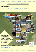
[en] A historical topographic map from the early 19th century, the Tranchot and v. Müffling map covers most of the German part of the Greater SaarLorLux Region. Müffling covers most of the German part of the Greater SaarLorLux Region. Together with the Cassini Map for the French part and the Ferraris Map for Wallonia and the Grand Duchy of Luxembourg, the situation before the revolutionary changes by the industrial revolution can be represented for most of the Greater SaarLorLux Region. In order to explain the map of Tranchot and v. Müffling for the GR-Atlas extracts from Carl, Marie-Luise 2004: "Der Hintergrund zur Kartenaufnahme der Rheinlande durch Tranchot und von Müffling im Spiegel einer Inschrift", largely based on Schmidt, R. 1973 and Effertz, P. 1990, are assembled here.
[de] Die Karte von Tranchot und v. Müffling, eine historische topografische Karte aus dem frühen 19. Jahrhundert, deckt den größten Teil des deutschen Teils der Großregion SaarLorLux ab. Zusammen mit der Carte de Cassini für den französischen Teil und der Carte Ferraris für Wallonien und das Großherzogtum Luxemburg lässt sich die Situation vor den revolutionären Veränderungen durch die industrielle Revolution für den größten Teil der Großregion SaarLorLux darstellen. Um die Karte von Tranchot und v. Müffling für den GR-Atlas zu erläutern, werden hier Auszüge aus Carl, Marie-Luise 2004: "Der Hintergrund zur Kartenaufnahme der Rheinlande durch Tranchot und von Müffling im Spiegel einer Inschrift", die größtenteils auf Schmidt, R. 1973 und Effertz, P. 1990 basieren, zusammengestellt.