Territoires; Grande Région; SaarLorLux; Territories; Greater Région; Territorien; Großregion
Abstract :
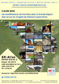
[fr] Les modifications territoriales de la Grande Région depuis 1815 sont présentées en dix cartes. La carte temporale montre la situation territoriale dans une année définie dès 1815 (Si la carte n'apparait pas après quelques secondes, il pourrait être nécessaire de recharger la page). Après l'activation de la timeline on peut choisir une année (mettre les deux régulateurs sur la même année). En plus il est possible de laisser parcourir la carte par le temps comme un vidéo. On peut zoomer dans la carte, et on peut accéder des informations adéquates en cliquant sur un territoire. [de] Die territorialen Veränderungen in der Großregion seit 1815 werden in zehn Karten dargestellt. Die Zeitkarte zeigt die territoriale Situation in einem bestimmten Jahr ab 1815 (Wenn die Karte nach einigen Sekunden nicht erscheint, könnte es notwendig sein, die Seite neu zu laden). Nach der Aktivierung der Zeitachse kann man ein Jahr auswählen (beide Regler auf das gleiche Jahr stellen). Außerdem ist es möglich, die Karte wie ein Video durch die Zeit laufen zu lassen. Man kann in die Karte hineinzoomen und durch Anklicken eines Gebietes auf passende Informationen zugreifen. [en] The territorial changes of the Greater Region since 1815 are presented in ten maps. The timeline map shows the territorial situation in a defined year from 1815 onwards (if the map does not appear after a few seconds, it might be necessary to reload the page). After activating the timeline you can choose a year (set both controllers to the same year). In addition it is possible to let the map run through the time like a video. The map can be zoomed in and out, and you can access relevant information by clicking on a territory.
Disciplines :
History
Author, co-author :
Back, Claude
HELFER, Malte ; University of Luxembourg > Faculty of Humanities, Education and Social Sciences (FHSE) > Department of Geography and Spatial Planning (DGEO)
Editor :
PAULY, Michel ; University of Luxembourg > Faculty of Humanities, Education and Social Sciences (FHSE) > Identités, Politiques, Sociétés, Espaces (IPSE)
CARUSO, Geoffrey ; University of Luxembourg > Faculty of Humanities, Education and Social Sciences (FHSE) > Department of Geography and Spatial Planning (DGEO)
Language :
French
Title :
Les modifications territoriales dans la Grande Région SaarLorLux du Congrès de Vienne à aujourd hui
Alternative titles :
[en] Territorial changes in the Greater SaarLorLux Region from the Congress of Vienna to the present day [de] Territoriale Veränderungen in der Großregion SaarLorLux vom Wiener Kongress bis heute
Publication date :
2014
Publisher :
Department of Geography and Spatial Planning - University of Luxembourg, Esch-Belval, Luxembourg