Cross-Evaluation of Surface Meteorological Data and GNSS-derived Water Vapor with Re-analysis Information for South Georgia Island, South Atlantic Ocean - 2020
Poster (Scientific congresses, symposiums and conference proceedings)
Cross-Evaluation of Surface Meteorological Data and GNSS-derived Water Vapor with Re-analysis Information for South Georgia Island, South Atlantic Ocean
ERKIHUNE, Eshetu Nega; TEFERLE, Felix Norman; HUNEGNAW, Addisuet al.
Global Navigation Satellite Systems; Meteorology; Climate change; South Georgia; Atmospheric remote sensing; Precipitable water vapour
Abstract :
[en] As one of the most important components of the global hydrologic cycle, atmospheric water vapor shows significant variability in both space and time over a large range of scales. This variability results from the interactions of many different factors, including topography and the presence of specific atmospheric processes. One of the key regions for affecting global climatic variations lies in the sub-Antarctic zone over the Southern Ocean with its Antarctic Circumpolar Current and the associated Antarctic Convergence. There, in this cold and maritime region, lies South Georgia Island with its weather and climate being largely affected by both the dominating ocean currents and the strong east ward blowing winds in this zone. While the island forms an important outpost for various surface observations in this largely under-sampled and extremely remote region, it also forms a barrier for these winds due to its high topography, which, in turn, leads to various local meteorological phenomena, such as foehn winds. Surface meteorological data have been available for several stations near King Edward Point (KEP) on South Georgia for much of the 20th century. Since 2013 and 2014, Global Navigation Satellite System (GNSS) data have been available at five locations around the periphery of the island and during a few months in 2016 also radiosonde data have been collected at KEP.
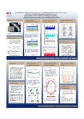
This study aims at investigating the consistency between the different surface meteorological data sets such as temperature, pressure and wind direction/speed that have been collected at KEP and a nearby GNSS station on Brown Mountain (BMT) for which we also compare the precipitable water vapor estimates. A cross-evaluation of these data sets with model values from the ERA-Interim re-analyses is carried out to further investigate the performance of both instruments and models.
Overall, our preliminary results show high consistency between the surface meteorological observations and the re-analysis model values. It was our main objective to investigate the homogeneity and accuracy of the BMT observation time series through cross-evaluation with the series of the official WMO station at KEP. Air temperature and pressure at both sites from observation and model data are strongly correlated at hourly intervals, reaching correlation coefficients in the range of 0.966 - 0.968 for the former data set. The difference temperature time series shows seasonal variations but no obvious steps. The difference pressure time series is flat, also indicating no discontinuities. A cross-evaluation of the wind observations shows the distinct directional feature at KEP for a station in a valley where the winds are funneled through the valley. For BMT the wind observations confirm the main directions of winds but also show the openness of the station from all directions. The observations of temperature, pressure, humidity and GNSS-derived PWV clearly show the signatures of the frequent foehn events.
Research center :
ULHPC - University of Luxembourg: High Performance Computing
Disciplines :
Earth sciences & physical geography
Author, co-author :
ERKIHUNE, Eshetu Nega ; University of Luxembourg > Faculty of Science, Technology and Medicine (FSTM) > Department of Engineering (DoE)
TEFERLE, Felix Norman ; University of Luxembourg > Faculty of Science, Technology and Medicine (FSTM) > Department of Engineering (DoE)
HUNEGNAW, Addisu ; University of Luxembourg > Faculty of Science, Technology and Medicine (FSTM) > Department of Engineering (DoE)
Cross-Evaluation of Surface Meteorological Data and GNSS-derived Water Vapor with Re-analysis Information for South Georgia Island, South Atlantic Ocean
Alternative titles :
[en] Cross-Evaluation of Surface Meteorological Data and GNSS-derived Water Vapor with Re-analysis Information for South Georgia Island, South Atlantic Ocean
Publication date :
11 December 2020
Number of pages :
iPoster (1920px x 1080px)
Event name :
AGU Fall Meeting
Event organizer :
American Geophysical Union
Event place :
Virtual Everywhere, United States
Event date :
01-12-2020 to 17-12-2020
Audience :
International
Focus Area :
Computational Sciences
FnR Project :
FNR12909050 - Advanced Asymmetry Tropospheric Products For Meteorology From Gnss And Sar Observations, 2018 (01/02/2019-31/07/2022) - Norman Teferle