
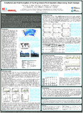
  | ERKIHUNE, E. N., TEFERLE, F. N.* , HUNEGNAW, A.* , & DUMAN, H.*. (14 December 2023). Multi-GNSS Precise Point Positioning with Ambiguity Resolution using IGS Products: A Cross-Evaluation of Three Software Packages and Combinations of Constellation Data for Geophysical Investigations [Poster presentation]. American Geophysical Union (AGU23) Conference. * These authors have contributed equally to this work. |
 | Schöne, T., Bingley, R., Craddock, A., Deng, Z., Gravelle, M., Guichard, M., Hansen, D., Herring, T., HUNEGNAW, A., Jia, M., King, M., Masoumi, S., Merrifield, M., Mitchum, G., Prouteau, E., Sanchez, L., Santamaria-Gomez, A., Teferle, F. N., Thaller, D., ... Wöppelmann, G. (2023). Tide Gauge Benchmark Monitoring Working Group Technical Report 2022. In R. B. Dach (Ed.), IGS International GNSS Service: Technical Report 2022 (pp. 229 - 232). Bern: IGS Central Bureau and University of Bern. doi:10.48350/179297  Editorial reviewed Editorial reviewed |
 | Hunegnaw, A., Duman, H., Ejigu, Y. G., Baltaci, H., Dousa, J., & Teferle, F. N. (20 January 2023). On the Impact of GPS Multipath Correction Maps and Post-Fit Residuals on Slant Wet Delays for Tracking Severe Weather Events. Atmosphere, 14 (219), 1-26. doi:10.3390/atmos14020219 Peer Reviewed verified by ORBi |
 | Teferle, F. N., Hunegnaw, A., Duman, H., Baltaci, H., Ejigu, Y. G., & Dousa, J. (14 December 2022). On Improving Slant Wet delays for Tracking Severe Weather Events: An evaluation During Two Storms in Europe [Paper presentation]. American Geophysical Union (AGU) Fall Meeting 2022, Chicago, IL, USA, United States. |
 | Erkihune, E. N., Teferle, F. N., & Hunegnaw, A. (12 December 2022). First Results of the GNSS Reprocessing at the University of Luxembourg for an Updated Global Vertical Land Movement Data Set [Paper presentation]. American Geophysical Union (AGU) Fall Meeting 2022, Chicago, IL, USA, United States. |
 | Teferle, F. N., Hunegnaw, A., Duman, H., Baltaci, H., Ejigu, J. G., & Dousa, J. (07 July 2022). On the Application of Multipath Stacking Maps for Improved Severe Weather Tracking and Low-cost Antenna Calibration [Paper presentation]. International Summit Forum of Engineering Science and Technology on «Beidou/GNSS Navigation and Location Service in Intelligent Era», Wuhan, China. |
 | Hunegnaw, A., Duman, H., Elgered, G., Dousa, J., & Teferle, F. N. (26 May 2022). Analysis of GNSS sensed slant wet delay during severe weather events in central Europe [Paper presentation]. EGU General Assembly 2022, Vienna, Austria. |
 | Hunegnaw, A., & Teferle, F. N. (28 April 2022). Evaluation of the Multipath Environment Using Electromagnetic-Absorbing Materials at Continuous GNSS Stations. Sensors, 22 (9), 1-23. doi:10.3390/s22093384 Peer Reviewed verified by ORBi |
 | Nurunnabi, A. A. M., TEFERLE, F. N., Li, J., Lindenbergh, R., & HUNEGNAW, A. (2021). An efficient deep learning approach for ground point filtering in aerial laser scanning point clouds. In A. A. M. Nurunnabi, F. N. Teferle, J. Li, R. Lindenbergh, ... A. Hunegnaw, An efficient deep learning approach for ground point filtering in aerial laser scanning point clouds (pp. 31-38). ISPRS. doi:10.5194/isprs-archives-XLIII-B1-2021-31-2021 Peer reviewed |
 | Yuan, P., Hunegnaw, A., Alshawaf, F., Awange, J., Klos, A., Teferle, F. N., & Kutterer, H. (01 July 2021). Feasibility of ERA5 integrated water vapor trends for climate change analysis in continental Europe: An evaluation with GPS (1994–2019) by considering statistical significance. Remote Sensing of Environment, 260 (112416). doi:10.1016/j.rse.2021.112416 Peer reviewed |
 | Hunegnaw, A., Ejigu, Y. G., Teferle, F. N., & Elgered, G. (24 April 2021). Multi-GNSS Slant Wet Delay Retrieval Using Multipath Mitigation Maps [Paper presentation]. EGU General Assembly Conference, online, Austria. |
 | Ejigu, Y. G., Teferle, F. N., Klos, A., Bogusz, J., & Hunegnaw, A. (2021). Monitoring and prediction of hurricane tracks using GPS tropospheric products. GPS Solutions, (76). doi:10.1007/s10291-021-01104-3 Peer Reviewed verified by ORBi |
 | Hunegnaw, A., Teferle, F. N., Elgered, G., & Ejigu, Y. G. (17 December 2020). Multipath Mitigation Maps feasibility and applicability as an International GNSS Service product [Paper presentation]. AGU Fall Meeting, online, United States. |
 | Teferle, F. N., Hunegnaw, A., Hibbert, A., Williams, S. D. P., Woodworth, P. L., Dalziel, I., Smalley, R. J., & Lawver, L. (16 December 2020). Vertical Land Movements and Sea Level Changes on South Georgia, South Atlantic Ocean: Results from 7 Years of Geodetic and Oceanographic Observations on a Remote Island [Paper presentation]. AGU Fall Meeting, Online Everywhere, United States. |
Erkihune, E. N., Teferle, F. N., Hunegnaw, A., & Dousa, J. (11 December 2020). Test [Poster presentation]. AGU Fall Meeting, Online Everywhere, United States. |
 | Erkihune, E. N., Teferle, F. N., Hunegnaw, A., & Dousa, J. (11 December 2020). Cross-Evaluation of Surface Meteorological Data and GNSS-derived Water Vapor with Re-analysis Information for South Georgia Island, South Atlantic Ocean [Poster presentation]. AGU Fall Meeting, Virtual Everywhere, United States. |
 | Monteiro, C., Hunegnaw, A., & Teferle, F. N. (25 February 2020). Low-cost GNSS for Meteorology: A receiver comparison [Poster presentation]. Improving GNSS & SAR Tropospheric Products for Meteorology, Luxembourg, Luxembourg. |
 | Olivares Pulido, G., Teferle, F. N., & Hunegnaw, A. (2020). Markov Chain Monte Carlo and the Application to Geodetic Time Series Analysis. In J.-P. Montillet & M. Bos, Geodetic Time Series Analysis in Earth Sciences (1st ed, pp. 53-138). Springer. doi:10.1007/978-3-030-21718-1_3 |
 | Ejigu, Y. G., Teferle, F. N., klos, A., Bogusz, J., & Hunegnaw, A. (2020). Tracking Hurricanes using GPS atmospheric precipitable water vapor field. In Beyond 100: The Next Century in Geodesy. Heidelberg, Germany: Springer. Peer reviewed |
 | Teferle, F. N., Hunegnaw, A., Hibbert, A., Williams, S., Woodworth, P., Dalziel, I., Smalley, R. J., & Lawver, L. (13 December 2019). Consolidating Observation of Land and Sea Level Changes around South Georgia Island [Poster presentation]. AGU Fall Meeting 2019, San Francisco, United States. |
 | Bogusz, J., Hunegnaw, A., Teferle, F. N., & Klos, A. (13 December 2019). Using the Vertical Land Movement estimates from the IGS TIGA combined solution to derive Global Mean Sea Level changes [Paper presentation]. AGU Fall Meeting 2019, San Francisco, United States. |
 | Ejigu, Y. G., Teferle, F. N., Hunegnaw, A., Klos, A., & Bogusz, J. (10 December 2019). Tracking hurricanes Harvey and Irma using GPS tropospheric products [Poster presentation]. AGU Fall Meeting, San Francisco, United States. |
 | Teferle, F. N., Dalziel, I. W. D., Hunegnaw, A., Hibbert, A., Williams, S. D. P., Woodworth, P. L., Smalley, R. J., & Lawver. (25 July 2019). Present-Day Land and Sea Level Changes around South Georgia Island: Results from Precise Levelling, GNSS, Tide Gauge and Satellite Altimetry Measurements [Paper presentation]. 13th International Symposium on Antarctic Earth Science (ISAES), Incheon, South Korea. |
 | Teferle, F. N., Hunegnaw, A., Backes, D., Hibbert, A., Williams, S. D. P., Woodworth, P. L., & Pugh, J. P. (11 July 2019). Recent Activities on Tristan da Cunha Island: Geodetic Installations, Local Tie Measurements and their Analysis [Paper presentation]. 27th IUGG General Assembly, Montréal, Canada. |
 | Ejigu, Y. G., Teferle, F. N., klose, A., Bogusz, J., & Hunegnaw, A. (09 April 2019). Improved Monitoringand Tracking Hurricanes using GPS Atmospheric WaterVapour [Poster presentation]. EGU General Assembly, Vienna, Austria. |
 | Ejigu, Y. G., Hunegnaw, A., Abraha, K. E., & Teferle, F. N. (January 2019). Impact of GPS Antenna Phase Center Models on Zenith Wet Delay and Tropospheric Gradients. GPS Solutions, 23 (5). doi:10.1007/s10291-018-0796-9 Peer Reviewed verified by ORBi |
 | Abraha, K. E., Teferle, F. N., Hunegnaw, A., & Dach, R. (23 June 2018). Effect of unmodelled tidal displacements in GPS and GLONASS coordinate time series. Geophysical Journal International, 214 (3), 2195-2206. doi:10.1093/gji/ggy254 Peer Reviewed verified by ORBi |
 | Teferle, F. N., Hunegnaw, A., Abraha, K. E., Woodworth, P., Williams, S., Hibbert, A., Smalley, R., Dalziel, I., & Lawver, L. (09 April 2018). Vertical Land Movements and Sea Level Changes around South Georgia Island [Poster presentation]. European Geosciences Union General Assembly 2018, Vienna, Austria. |
 | Klos, A., Hunegnaw, A., Teferle, F. N., Abraha, K. E., Ahmed, F., & Bogusz, J. (2018). Statistical significance of trends in Zenith Wet Delay from re-processed GPS solutions. GPS Solutions. doi:10.1007/s10291-018-0717-y Peer Reviewed verified by ORBi |
 | Teferle, F. N., Hunegnaw, A., Abraha, K. E., Woodworth, P., Williams, S., Hibbert, A., Smalley, R., Dalziel, I., & Lawver, L. (11 December 2017). First Vertical Land Movement Estimates on South Georgia Island: An Impact Study on Sea Level Change from Tide Gauge and Altimetry Measurements [Poster presentation]. American Geophysical Union Fall Meeting 2017, New Orleans, 10-15 December 2017, United States. |
 | Klos, A., Olivares Pulido, G., Teferle, F. N., Hunegnaw, A., & Bogusz, J. (2017). On the combined effect of periodic signals and colored noise on velocity uncertainties. GPS Solutions. doi:10.1007/s10291-017-0674-x Peer Reviewed verified by ORBi |
 | Hunegnaw, A., Teferle, F. N., Abraha, K. E., Bingley, R., Hansen, D., Deng, Z., Schöne, T., Santamaria-Gomez, A., Gravelle, M., Wöppelmann, G., Sanchez, L., Moore, M., & Jia, M. (13 July 2017). A Global Vertical Land Movement Data Set from a Combination of Global Navigation Satellite System Solutions [Poster presentation]. International WCRP/IOC Conference 2017 Regional Sea Level Changes and Coastal Impacts, New York, United States. |
 | Hunegnaw, A., Teferle, F. N., Abraha, K. E., Santamaria-Gomez, A., Gravelle, M., Wöppelmann, G., Schöne, T., Deng, Z., Bingley, R., Hansen, D., Sanchez, L., & Moore, M. (03 July 2017). On the Scientific Applications of IGS Products: An Assessment of the Reprocessed TIGA Solutions and Combined Products [Paper presentation]. IGS Workshop 2017, Pathways to Improved Precision, Paris, France. |
 | Ahmed, F., Hunegnaw, A., Teferle, F. N., & Bingley, R. (27 April 2017). Evaluation of ERA-Interim for tropospheric delay and water vapour estimation in different climate zones using ground-based GNSS observations [Poster presentation]. European Geoscience Union General Assembly 2017, Vienne, Austria. |
 | Hunegnaw, A., Teferle, F. N., & Abraha, K. E. (23 April 2017). A New Global Vertical Land Movement Data Set from the TIGA Combined [Poster presentation]. European Geosciences Union General Assembly, Vienna, Austria. |
 | Klos, A., Hunegnaw, A., Teferle, F. N., Abraha, K. E., Ahmed, F., & Bogusz, J. (22 February 2017). Noise characteristics in Zenith Total Delay from homogeneously reprocessed GPS time series [Paper presentation]. COST Action ES1206 GNSS4SWEC Final Workshop, Noordwijk, Netherlands. |
 | Hunegnaw, A., Teferle, F. N., Abraha, K. E., Bingley, R., & Hansen, D. (12 December 2016). Error analysis of Tide Gauge Benchmark Monitoring (TIGA) Analysis Center stacked solutions [Poster presentation]. AGU Fall Meeting 2016, San Francisco, CA, USA, 12-16 December, San Francisco, United States. |
 | Abraha, K. E., Teferle, F. N., Hunegnaw, A., & Dach, R. (12 December 2016). On the Impact of Multi-GNSS Solutions on Satellite Products and Positioning [Poster presentation]. American Geophysical Union (AGU) Fall Meeting 2016, San Francisco, United States. |
 | Abraha, K. E., Teferle, F. N., Hunegnaw, A., & Dach, R. (2016). GNSS related periodic signals in coordinate time-series from Precise Point Positioning. Geophysical Journal International. doi:10.1093/gji/ggw467 Peer Reviewed verified by ORBi |
 | Hunegnaw, A., Klos, A., Hansen, D., Teferle, F. N., Abraha, K. E., Bingley, R., & Bogusz, J. (30 July 2016). A New Vertical Land Movements Data Set from a Reprocessing of GNSS at Tide Gauge Stations [Paper presentation]. IAG/CPGPS International Conference on GNSS+ (ICG+ 2016) Advances, Opportunities and Challenges, Shanghai, China. |
 | Teferle, F. N., Ding, W., Abraha, K. E., Hunegnaw, A., Laurichesse, D., Dach, R., Kazmierski, K., & Yunbin, Y. (30 July 2016). Multi-GNSS Benefits to Real-Time and Long-Term Monitoring Applications [Paper presentation]. IAG/CPGPS International Conference on GNSS+ (ICG+ 2016) Advances, Opportunities and Challenges, Shanghai, China. |
 | Klos, A., Teferle, F. N., Hunegnaw, A., Ahmed, F., Abraha, K. E., & Bogusz, J. (29 July 2016). On the Properties of Zenith Total Delay Time Series from Reprocessed GPS Solutions [Poster presentation]. IAG/CPGPS International Conference on GNSS+ (ICG+ 2016) - Advances, Opportunities and Challenges, Shanghai, China. |
 | Abraha, K. E., Teferle, F. N., Hunegnaw, A., & Dach, R. (2016). Impact of Limited Satellite Visibility on Estimates of Vertical Land Movements. International Association of Geodesy Symposia, 1-8. doi:10.1007/1345_2016_231 Peer Reviewed verified by ORBi |
 | Klos, A., Hunegnaw, A., Bos, M., Teferle, F. N., Fernandes, R., & Bogusz, J. (June 2016). Accessing of Post-SPeoiswmeirc-LDaewfoPrrmoapteiortnies in Land Movements [Paper presentation]. 18th International Symposium on Geodynamics and Earth Tides, Trieste, Italy. |
 | Hunegnaw, A., Teferle, F. N., Bingley, R., & Hansen, D. (May 2016). Status of TIGA activities at the British Isles continuous GNSS Facility and the University of Luxembourg. International Association of Geodesy Symposia, 143, 617-623. doi:10.1007/1345_2015_77 Peer Reviewed verified by ORBi |
 | Hunegnaw, A., & Teferle, F. N. (19 April 2016). Combination of Tide Gauge Benchmark Monitoring (TIGA) Analysis Center from repro2 solutions [Poster presentation]. EGU General Assembly 2016, Austria. |
 | Klos, A., Olivares Pulido, G., Teferle, F. N., Hunegnaw, A., & Bogusz, J. (05 April 2016). The Combined Effect of Periodic Signals and Noise on the Dilution of Precision of GNSS Station Velocity Uncertainties [Poster presentation]. EGU General Assembly 2015, Vienna, Austria, 17-22 April 2016, Vienna, Austria. |
 | Teferle, F. N., Combrinck, L., Botha, R., Hunegnaw, A., Abraha, K. E., & Ding, W. (11 February 2016). A First Evaluation of the new GNSS Station Installations at the Tide Gauges of Walvis Bay and Lüderitz in the Republic of Namibia [Poster presentation]. IGS Workshop 2016, Sydney, Australia. |
 | Klos, A., Olivares, G., Teferle, F. N., Bogusz, J., & Hunegnaw, A. (05 February 2016). Total Impact of Periodic Terms and Coloured Noise on Velocity Estimates [Poster presentation]. IGS Workshop, Sydney, Australia. |
 | Hunegnaw, A., & Teferle, F. N. (February 2016). Quality assessment of Mulit-Year BLT Tide Gauge Benchmark Monitoring (TIGA) repro2 Solution [Poster presentation]. IGS2016 Workshop, Sydney, Australia. |
 | Teferle, F. N., Hunegnaw, A., Ahmed, F., Sidorov, D., Woodworth, P. L., Foden, P. R., & Williams, S. P. D. (2016). The King Edward Point Geodetic Observatory, South Georgia, South Atlantic Ocean: A First Evaluation and Potential Contributions to Geosciences. In P. Willis & C. Rizos (Eds.), IAG 150 Years Proceedings of the 2013 IAG Scientific Assembly, Postdam, Germany, 1–6 September, 2013 (pp. 625-630). Heidelberg, Germany: Springer. doi:10.1007/1345_2015_175 Peer reviewed |
 | Hunegnaw, A., & Teferle, F. N. (17 December 2015). Assessment of BLT Tide Gauge Benchmark Monitoring (TIGA) repro2 Solutions [Poster presentation]. AGU Fall Meeting 2015, San Francisco, CA, USA, 14-18 December, San Francisco, United States. |
 | Abraha, K. E., Teferle, F. N., Hunegnaw, A., & Dach, R. (27 October 2015). Signal Obstructions at GNSS Stations: Benefits From Multi-GNSS Observations [Poster presentation]. 5th International Colloquium on Scientific and Fundamental Aspects of the Galileo Programme, Braunschweig, Germany. |
 | Abraha, K. E., Teferle, F. N., Hunegnaw, A., & Dach, R. (27 June 2015). Impact of Limited Multi-GNSS Visibility on Vertical Land Movement Estimates [Poster presentation]. 26th General Assembly of the International Union of Geodesy and Geophysics (IUGG), Prague, Czechia. |
 | Teferle, F. N., Hunegnaw, A., Woodworth, P. L., Foden, P. R., Williams, S. D. P., Pugh, J., & Hibbert, A. (27 June 2015). Calibration of the Tide Gauge at King Edward Point, South Georgia Island, South Atlantic Ocean [Poster presentation]. 26th General Assembly of the International Union of Geodesy and Geophysics (IUGG), Prague, Czechia. |
 | Ahmed, F., Hunegnaw, A., Teferle, F. N., & Bingley, R. (26 June 2015). Analysis of Global Climate Variability from Homogenously Reprocessed Ground-based GNSS Measurements [Poster presentation]. 26th IUGG General Assembly, Prague, Czechia. |
Teferle, F. N., Hunegnaw, A., Woodworth, P. L., Foden, P. R., Williams, S. D. P., Pugh, J., & Hibbert, A. (12 June 2015). A New Datum-Controlled Tide Gauge Record for Sea Level Studies in the South Atlantic Ocean: King Edward Point, South Georgia Island [Poster presentation]. Global and Regional Sea Level Variability and Change, Palma de Mallorca, Spain. |
 | Ahmed, F., Hunegnaw, A., Teferle, F. N., & Bingley, R. (14 April 2015). Analysis of global climate variability from homogenously reprocessed ground-based GNSS measurements [Paper presentation]. European Geosciences Union General Assembly 2015, Vienna, Austria. |
 | Hunegnaw, A., & Teferle, F. N. (12 April 2015). A Multi-Year Combination of Tide Gauge Benchmark Monitoring (TIGA) Analysis Center Products [Poster presentation]. EGU General Assembly 2015, Vienna, Austria, 12-17 April 2015, Vienna, Austria. |
 | Teferle, F. N., Hunegnaw, A., Woodworth, P. L., Foden, P. R., Williams, S. D. P., Hibbert, A., & Pugh, J. (12 March 2015). Calibration of the Tide Gauge at King Edward Point, South Georgia Island [Poster presentation]. UK Sea Level Science Meeting, Liverpool, United Kingdom. |
Hunegnaw, A., & Teferle, F. N. (2015). Assessment of BLT Tide Gauge Benchmark Monitoring (TIGA) repro2 solutions [Poster presentation]. AGU Fall Meeting 2015, San Francisco, CA, USA, 14-18 December. |
 | Ahmed, F., Hunegnaw, A., Teferle, F. N., & Bingley, R. (17 December 2014). An analysis of global climate variability from homogeneously reprocessed GNSS measurements [Poster presentation]. American Geophysical Union Fall Meeting 2014, San Francisco, United States. |
 | Hunegnaw, A., Teferle, F. N., Bingley, R., & Hansen, D. (16 December 2014). A Multi-Year Combination of Tide Gauge Benchmark Monitoring (TIGA) Analysis Center Products: Preliminary results [Poster presentation]. AGU Fall Meeting 2014, San Francisco, CA, USA, 15-19 December. |
 | Teferle, F. N., Hunegnaw, A., Williams, S., Foden, P., & Woodworth, P. (26 July 2014). Recent Activities at the King Edward Point Geodetic Observatory, South Georgia, in Support of TIGA Objectives [Poster presentation]. IGS Workshop 2014: Celebrating 20 Years of Service 1994-2014, Pasadena, United States. |
 | Teferle, F. N., Hunegnaw, A., Ahmed, F., Woodworth, P. L., Foden, P. R., & Williams, S. D. P. (28 October 2013). The King Edward Point Geodetic Observatory in Support of Sea Level Research [Poster presentation]. PSMSL 80th Anniversary Workshop on Sea Level Science, Liverpool, United Kingdom. |
 | Teferle, F. N., Hunegnaw, A., Ahmed, F., Sidorov, D., Williams, S., Foden, P., & Woodworth, P. (01 September 2013). Potential Contributions to Geoscience from GNSS Observations of the King Edward Point Geodetic Observatory, South Georgia, South Atlantic Ocean [Poster presentation]. IAG Scientific Assembly 2013, IAG 150 Years, Potsdam, Germany. |
 | Teferle, F. N., White, S. W., Foden, P. R., Strachan, R., Whittamore, L. P., Woodworth, P. L., Williams, S. D. P., Hunegnaw, A., & Ahmed, F. (May 2013). Installation and First Evaluation of the King Edward Point Geodetic Observatory, South Georgia [Poster presentation]. The Scotia Arc: Geodynamic Evolution and Global Implications, Granada, Spain. |
 | Hunegnaw, A., Teferle, F. N., Bingley, R., & Hansen, D. (2013). Status of TIGA activities at the British Isles continuous GNSS Facility and the University of Luxembourg [Paper presentation]. IAG Scientific Assembly 2013, IAG 150 Years, Potsdam, Germany. |
 | Hunegnaw, A., Hipkin, R., & Edwards, J. (2009). A method of error adjustment for marine gravity with application to Mean Dynamic Topography in the northern North Atlantic. Journal of Geodesy, 83 (2), 161-174. doi:10.1007/s00190-008-0249-2 Peer reviewed |
 | Hunegnaw, A., Siegismund, F., Hipkin, R., & Mork, K. A. (2009). Absolute flow field estimation for the Nordic seas from combined gravimetric, altimetric, and in situ data. Journal of Geophysical Research. Oceans, 114 (C2). doi:10.1029/2008JC004797 Peer reviewed |
 | Knudsen, P., Andersen, O., Forsberg, R., Föh, H., Solheim, D., Omang, O., Hipkin, R., Hunegnaw, A., Haines, K., Bingham, R., Drecourt, J.-P., Johannessen, J., Drange, H., Siegismund, F., Hernandez, F., Rio, M.-H., Schaeffer, P., & Larnicol, G. (2007). Combining altimetric/gravimetric and ocean model mean dynamic topography models in the GOCINA region. In International Association of Geodesy Symposia. doi:10.1007/978-3-540-49350-1_1 Peer reviewed |