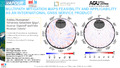
[en] There have been many advances in the modeling of Global Navigation Satellite System (GNSS) observables when estimating position and other parameters of interest. Some of these bias models are related to improvements of reference frames, phase center offsets and variations of transmitter and receiver antennas, satellite orbits and clocks, and troposphere. Nonetheless, multipath remains for the most part an unmodelled source of error which causes range errors in the GNSS observations. The associated effects show highly localized features and have a different impact for each receiver and antenna. Multipath errors can propagate, can cause in-situ position biases and are also contributing to the prevalent draconitic harmonic signals. In order to mitigate the problem we generate site-specific corrections by employing a suitable averaging scheme for the stacking of carrier phase residuals. Our processing is based on globally distributed static multi-GNSS observations using several scientific GNSS software packages (Bernese GNSS Software, NAPEOS, GAMIT-GLOBK, and CSRS-PPP). Our multipath stacking maps (MPS) use the stacking of carrier phase residuals generated by variable azimuth cell size (congruent cells) and by allocating carrier phase residuals in each cell to generate the correction maps, unlike the standard fixed azimuth cell resolution approaches. This reduces the binning of fewer residuals at higher elevation angles. Before stacking, we also apply rigorous statistical outlier screening tests for each one-way post-fit carrier phase residual assigned to each of the congruent cells. We thus correct the multipath effects by subtracting the stacked multipath map from the post-fit carrier phase residual. Using this technique we produce a model available in the form of the Antenna Exchange (ANTEX) file format, that can potentially be implemented in routine GNSS analysis with no or little additional overhead for individual analysis centers (ACs). In this study, we assess the feasibility and applicability of the MPS maps as an International GNSS Service (IGS) product for routine GNSS analysis. We demonstrate the multipath stacking technique to result in a significant reduction of the variation in the one-way post-fit carrier phase residuals from multi-GNSS observations.
Disciplines :
Earth sciences & physical geography
Author, co-author :
HUNEGNAW, Addisu ; University of Luxembourg > Faculty of Science, Technology and Medicine (FSTM) > Department of Engineering (DoE)
TEFERLE, Felix Norman ; University of Luxembourg > Faculty of Science, Technology and Medicine (FSTM) > Department of Engineering (DoE)
Elgered, Gunnar; Chalmers University of Technology, Sweden
Ejigu, Yohannes Getachew
External co-authors :
yes
Language :
English
Title :
Multipath Mitigation Maps feasibility and applicability as an International GNSS Service product
Publication date :
17 December 2020
Number of pages :
17
Event name :
AGU Fall Meeting
Event organizer :
American Geophysical Union
Event place :
online, United States
Event date :
01-12-2020 to 17-12-2020
Audience :
International
References of the abstract :
Abstract ID: 758264
Final Paper Number: G026-04
Presentation Type: Oral Session
Session Date and Time: Thursday, 17 December 2020; 07:00 - 08:00 PST
Presentation Length: 07:12 - 07:16 PST
Session Number and Title: G026: Scientific
Applications Enabled by the International GNSS Service
(IGS) and Associated Improvements to GNSS Products I