Vertical Land Movements and Sea Level Changes on South Georgia, South Atlantic Ocean: Results from 7 Years of Geodetic and Oceanographic Observations on a Remote Island - 2020
Unpublished conference/Abstract (Scientific congresses, symposiums and conference proceedings)
Vertical Land Movements and Sea Level Changes on South Georgia, South Atlantic Ocean: Results from 7 Years of Geodetic and Oceanographic Observations on a Remote Island
TEFERLE, Felix Norman; HUNEGNAW, Addisu; Hibbert, Angelaet al.
Global Navigation Satellite System; vertical land movements; sea level rise; South Georgia; tide gauge; climate change
Abstract :
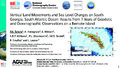
[en] South Georgia Island in the South Atlantic Ocean, is a small remote land mass that supports various ground-based instrumental observations (Global Navigation Satellite System (GNSS), tide gauge, meteorological and seismic) in an otherwise largely under sampled oceanic region. Moreover, the South Atlantic Ocean plays an important role in global ocean circulation, con-necting the deep thermohaline circulation of the North Atlantic and Indian Oceans, whilst also linking to the Antarctic Circumpolar Current in the South, where the lack of continental barriers allows a free exchange of water between the major ocean basins. Hence, South Georgia po-tentially lies within a region susceptible to climatic changes before these can be felt further afield.
In 2013 and 2014 a total of five GNSS stations were installed covering the area of the main island (approximately 170 x 50 km) with two of those being located close to the King Edward Point (KEP) Research Station and the GLOSS tide gauge (ID 187). Furthermore, precise levelling campaigns in 2013, 2014, 2017 and 2020 supported the analysis of local ground instabilities near the tide gauge. Through these activities the tide gauge datum within the Permanent Ser-vice for Mean Sea Level (PSMSL) has been established, which in turn, makes the derived KEP mean sea level (MSL) record highly valuable for long-term studies and satellite altimetry cali-brations.
In this study, we will present the vertical land movement estimates from seven years of GNSS observations, five precise levelling campaigns, and will discuss their impact on the sea level record from the KEP tide gauge and nearby satellite altimetry sea surface heights. Our results confirm uplift all over South Georgia Island while the area at KEP and particularly the jetty with tide gauge are subsiding relative to the rest of the island. Using this information we correct the MSL record for the vertical land movements and investigate its signals together with those from nearby satellite altimetry tracks.
Disciplines :
Earth sciences & physical geography
Author, co-author :
TEFERLE, Felix Norman ; University of Luxembourg > Faculty of Science, Technology and Medicine (FSTM) > Department of Engineering (DoE)
HUNEGNAW, Addisu ; University of Luxembourg > Faculty of Science, Technology and Medicine (FSTM) > Department of Engineering (DoE)
Hibbert, Angela; National Oceanography Centre
Williams, Simon D P; National Oceanography Centre
Woodworth, Philip L; National Oceanography Centre
Dalziel, Ian; University of Texas at Austin
Smalley, Robert Jr; University of Memphis
Lawver, Laurence; University of Texas at Austin
External co-authors :
yes
Language :
English
Title :
Vertical Land Movements and Sea Level Changes on South Georgia, South Atlantic Ocean: Results from 7 Years of Geodetic and Oceanographic Observations on a Remote Island
Publication date :
16 December 2020
Number of pages :
26
Event name :
AGU Fall Meeting
Event organizer :
American Geophysical Union
Event place :
Online Everywhere, United States
Event date :
01-12-2020 to 17-12-2020
Audience :
International
References of the abstract :
Abstract ID: 743158
Abstract Title: Vertical Land Movements and Sea Level Changes on South Georgia, South Atlantic Ocean: Results from seven Years of Geodetic and Oceanographic Observations on a Remote Island
Final Paper Number: G022-04
Presentation Type: Oral Session
Session Date and Time: Wednesday, 16 December 2020; 05:30 - 06:30 PST
Presentation Length: 05:42 - 05:46 PST
Session Number and Title: G022: The Global Geodetic Observing System: Resilient Infrastructure for Sustainable Scientific Activities I