Abstract :
[en] Ever improving low cost, lightweight and easy to use sensing technologies are enabling the capture of rich 3D Datasets to support an unprecedented range of applications in Geosciences. Especially low-cost LiDAR systems as well as optical sensors, which can be deployed from terrestrial or low altitude aerial platforms, allow the collection of large datasets without detailed expert knowledge or training. Dense pointcloud derived from these technologies provide an invaluable source to fill the gap between highly precise and accurate terrestrial topographic surveys and large area Digital Surface Models (DSMs) derived from airborne and spaceborne sensors.
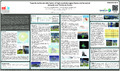
However, the collection of reliable 3D pointclouds in remote and hazardous locations remains to be very difficult and costly. Establishing a reliable georeference, ensuring accuracy and data quality as well as merging such rich datasets with existing or space borne mapping provide additional challenges. The presented case study investigates the data quality and integration of a heterogeneous dataset collected over the remote island of Tristan da Cunha. High-resolution 3D pointclouds derived by TLS and drone Photogrammetry are merged with space borne imagery while preserving the accurate georeference provided by Ground Control derived from geodetic observations.
The volcanic island of Tristan da Cunha located in the centre of the Southern Atlantic Ocean is one of the most remote and difficult to access locations on the planet. Its remote location, rough climatic conditions and consistent cloud coverage provides exceptional challenges for terrestrial, aerial as well as space borne data acquisition. Amongst many other scientific installations, the island also hosts a continuous GNSS station observation and monitoring facilities operated by the University of Luxembourg, which provided the opportunity to conduct a local terrestrial data acquisition campaign consistent with a terrestrial ground survey, Laserscanning and an image acquisition from a low-cost drone. The highly accurate Ground Control network, observed by GNSS and total station, provides a reliable georeference. Pointclouds were acquired around the area of the harbour using a Leica P20 terrestrial Laserscanner, as well as drone Photogrammetry based on images collected by a low-cost DJI Phantom3 drone. To produce a map of the complete island a comprehensive dataset of high-resolution space borne imagery based on the Digital Globe WorldView constellation was acquired which provided high resolution mapping information.
The case study presents a cross-validation of terrestrial, low altitude airborne as well as spaceborne datasets in terms coregistration, absolute georeference, scale, resolution and overall data quality. Following the evaluation a practical approach to fuse this heterogeneous dataset is applied which aims to preserve overall data quality, local resolution and accurate georeference and avoid edge artefacts. The conclusions drawn from our preliminary results provide some good practice advice for similar projects. The final topographic dataset enables mapping and monitoring of local geohazards as, e.g. coastal erosion and recent landslides thus also supporting the local population.
Disciplines :
Engineering, computing & technology: Multidisciplinary, general & others
Earth sciences & physical geography