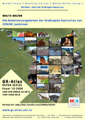
[de] Die Karte zeigt für das Projekt CORINE Land Cover aufbereitete Aufnahmen der Bodenbedeckung des Satelliten Landsat 7 aus den Jahren 1990, 2000 und 2006. Die kleinste dargestellte Einheit umfasst 25 Hektar, entsprechend 5x5mm im Maßstab 1:100 000. Die Mindestbreite einer linienförmigen Einheit beträgt 100m.
Disciplines :
Human geography & demography Earth sciences & physical geography
Author, co-author :
HELFER, Malte ; University of Luxembourg > Faculty of Language and Literature, Humanities, Arts and Education (FLSHASE) > Identités, Politiques, Sociétés, Espaces (IPSE)
Editor :
PAULY, Michel ; University of Luxembourg > Faculty of Language and Literature, Humanities, Arts and Education (FLSHASE) > Identités, Politiques, Sociétés, Espaces (IPSE)
CARUSO, Geoffrey ; University of Luxembourg > Faculty of Language and Literature, Humanities, Arts and Education (FLSHASE) > Identités, Politiques, Sociétés, Espaces (IPSE)
HELFER, Malte ; University of Luxembourg > Faculty of Language and Literature, Humanities, Arts and Education (FLSHASE) > Identités, Politiques, Sociétés, Espaces (IPSE)
Language :
German
Title :
Die Bodennutzungskarten der Großregion SaarLorLux von CORINE Landcover
Alternative titles :
[en] The land use maps of the Greater Region SaarLorLux from CORINE Landcover
Publication date :
2009
Publisher :
Institute of Geography and Spatial Planning - UR IPSE - University of Luxembourg, Esch, Luxembourg
FNR064221 - Digital Multidisciplinary, Interactive and Dynamic Atlas for Luxembourg and the Greater Region - LUXATLAS, (01/05/2007-30/04/2010) - Michel Pauly
Name of the research project :
Luxatlas, Webatlas
Funders :
FNR - Fonds National de la Recherche University of Luxembourg - UL