King Edward Point Geodetic Observatory; Global Navigation Satellite System; South Georgia Island; Tide gauge; precise levelling; geodetic surveying
Abstract :
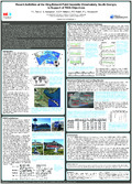
[en] In 2013 the King Edward Point (KEP) Geodetic Observatory was established in South Georgia, South Atlantic Ocean, in support of geoscience applications. South Georgia Island has been a key location for the seismic, geomagnetic and oceanic global monitoring networks. However, no geodetic permanent monitoring station had been established there despite the lack of observations from this region within the International GNSS Service (IGS) network of Global Navigation Satellite System (GNSS) stations. Currently, the observatory consists of two state-of-the-art GNSS stations (KEPA 42701M001 and KRSA 42702M001) with local benchmark networks, allowing the height determinations from the GNSS antennas to be transferred to the tide gauge (Global Sea Level Observing System 187) and forming a height reference within the International Terrestrial Reference Frame.
In this study, we will present an evaluation of the GNSS observations from the KEP Geodetic Observatory for the period from February 2013 to December 2013. We calculate multipath and positioning statistics and compare these to those from IGS stations. We report on the benchmark network and tide board installation, as well as, on the results from the two levelling campaigns carried out to date. For the future it is envisaged that the stations will contribute to the TIGA objective of monitoring vertical land movements at tide gauges, and that KEPA will contribute to the IGS network.
Disciplines :
Earth sciences & physical geography
Author, co-author :
TEFERLE, Felix Norman ; University of Luxembourg > Faculty of Science, Technology and Communication (FSTC) > Engineering Research Unit
HUNEGNAW, Addisu ; University of Luxembourg > Faculty of Science, Technology and Communication (FSTC) > Engineering Research Unit
Williams, Simon; National Oceanography Centre, Liverpool
Foden, Peter; National Oceanography Centre, Liverpool
Woodworth, Philip; National Oceanography Centre, Liverpool
Language :
English
Title :
Recent Activities at the King Edward Point Geodetic Observatory, South Georgia, in Support of TIGA Objectives
Publication date :
26 July 2014
Event name :
IGS Workshop 2014: Celebrating 20 Years of Service 1994-2014
Event organizer :
International GNSS Service
Event place :
Pasadena, United States
Event date :
23-06-2014 to 27-06-2014
Audience :
International
Name of the research project :
F1R-ING-PUL-12GSCG > GSCG > 01/04/2012 - 31/03/2015 > TEFERLE Felix Norman