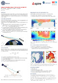
[en] The grazing angle signals of opportunities from Global Navigation Satellite System (GNSS) are used to perform precise sea-ice altimetry. The novel GNSS-Reflectometry (GNSS-R) would help to better understand the sea-ice distribution and classification in the polar regions.
Disciplines :
Earth sciences & physical geography
Author, co-author :
NAVARRO BUENDÌA, Raquel ; University of Luxembourg > Faculty of Science, Technology and Medicine (FSTM) > Department of Engineering (DoE)
External co-authors :
no
Language :
English
Title :
GNSS-R GRAZING ANGLE FOR SEA ICE ALTIMETRY
Publication date :
21 May 2021
Event name :
DTU DRIVEN Colloquium
Event organizer :
Andreas Zilian
Event place :
University of Luxembourg, Luxembourg
Event date :
21-05-2021
Focus Area :
Computational Sciences
FnR Project :
FNR12252781 - Data-driven Computational Modelling And Applications, 2017 (01/09/2018-28/02/2025) - Andreas Zilian