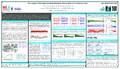
[en] In 2013 the International GNSS Service (IGS) Tide Gauge Benchmark Monitoring (TIGA) Working Group (WG) started their reprocessing campaign, which proposes to re-analyze all relevant Global Positioning System (GPS) observations from 1995 to the end of 2013. This re-processed dataset will provide high quality estimates of land motions, enabling regional and global high-precision geophysical/geodetic studies. Several of the individual TIGA Analysis Centers (TACs) have completed processing the full history of GPS observations recorded by the IGS global network, as well as, many other GPS stations at or close to tide gauges, which are available from the
TIGA data center at the University of La Rochelle (www.sonel.org). The TAC solutions contain a total of over 700 stations. This study focuses on the evaluations of any systematic error present in the three TIGA analysis center (TAC) SINEX solutions: the British Isles continuous GNSS Facility – University of Luxembourg consortium (BLT), the GeoForschungsZentrum (GFZ) Potsdam, and of the University of La Rochelle (ULR). We have analyzed the residual position time series of the individual TAC a combination of automatic and manual discontinuity identification, applying a post-seismic deformation model adopted from ITRF2014 for those stations that
are affected by earthquakes, followed by the stacking of the daily solution of the individual TAC into a long term linear frame. We have carried out the error analysis using the Combination and Analysis of Terrestrial Reference Frame (CATREF) software package. The TIGA Combination Centre (TCC) at the University of Luxembourg (UL) is responsible for providing a combined solution with a global set of vertical land movement estimates.
Research center :
University of Luxembourg, FSTC,High Performance Computing - ULHPC
Disciplines :
Earth sciences & physical geography
Author, co-author :
HUNEGNAW, Addisu ; University of Luxembourg > Faculty of Science, Technology and Communication (FSTC) > Engineering Research Unit
TEFERLE, Felix Norman ; University of Luxembourg > Faculty of Science, Technology and Communication (FSTC) > Engineering Research Unit
ABRAHA, Kibrom Ebuy ; University of Luxembourg > Faculty of Science, Technology and Communication (FSTC) > Engineering Research Unit
Bingley, Richard; University of Nottingham > British Isles continuous GNSS Facility, Nottingham Geospatial Institute
Hansen, Dionne; University of Nottingham > British Isles continuous GNSS Facility, Nottingham Geospatial Institute
External co-authors :
yes
Language :
English
Title :
Error analysis of Tide Gauge Benchmark Monitoring (TIGA) Analysis Center stacked solutions
Publication date :
12 December 2016
Event name :
AGU Fall Meeting 2016, San Francisco, CA, USA, 12-16 December