Greater Region; SaarLorLux; Natura 2000; Großregion
Abstract :
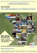
[en] Das System der Natura 2000-Schutzgebiete ist das Kernstück der Natur- und Biodiversitätspolitik der Europäischen Union. Es handelt sich um ein EU-weites Netzwerk von Schutzgebieten der Fauna-Flora-Habitatrichtlinie von 1992 (FFH-Richtlinie, vom 21. Mai 1992, 92/43/EWG) und der Vogelschutzrichtlinie von 1979 (vom 2. April 1979, 79/409/EWG). Die Karte zeigt die Natura 2000-Schutzgebiete der Großregion SaarLorLux im Jahr 2010.
HELFER, Malte ; University of Luxembourg > Faculty of Language and Literature, Humanities, Arts and Education (FLSHASE) > Identités, Politiques, Sociétés, Espaces (IPSE)
Editor :
PAULY, Michel ; University of Luxembourg > Faculty of Language and Literature, Humanities, Arts and Education (FLSHASE) > Identités, Politiques, Sociétés, Espaces (IPSE)
CARUSO, Geoffrey ; University of Luxembourg > Faculty of Language and Literature, Humanities, Arts and Education (FLSHASE) > Identités, Politiques, Sociétés, Espaces (IPSE)
HELFER, Malte ; University of Luxembourg > Faculty of Language and Literature, Humanities, Arts and Education (FLSHASE) > Identités, Politiques, Sociétés, Espaces (IPSE)
Language :
German
Title :
Natura 2000-Schutzgebiete in der Großregion SaarLorLux
Alternative titles :
[en] Natura 2000 reserves in the Greater Region SaarLorLux
Publication date :
2010
Publisher :
Institute of Geography and Spatial Planning - UR IPSE - University of Luxembourg, Esch, Luxembourg
FNR064221 - Digital Multidisciplinary, Interactive and Dynamic Atlas for Luxembourg and the Greater Region - LUXATLAS, (01/05/2007-30/04/2010) - Michel Pauly
Name of the research project :
Luxatlas, Webatlas
Funders :
FNR - Fonds National de la Recherche University of Luxembourg - UL